 BGS Data Catalogue
Drill core
Type of resources
Topics
Keywords
Contact for the resource
Provided by
Years
Formats
Representation types
Update frequencies
Scale
-

A core scanning dataset from part of the Ellesmere Port-1 drill core that was drilled for unconventional hydrocarbons in 2014. Approximate 40 m of core from the Bowland Shale Formation in the Ellesmere Port-1 (1532.7 – 1663.15 m) was scanned for high-resolution optical images and X-ray fluorescence (XRF) downcore point measurements using the Itrax MC core scanner (Cox Analytical Systems) at the Core Scanning Facility (CSF) at the British Geological Survey. Core scanning was utilised as part of the commission phase of this facility.
-
During the period from 1989 to 1997, Nirex undertook extensive geological investigations at sites near Sellafield, in Cumbria, and Dounreay, in Caithness, to examine whether or not they were suitable locations for a deep repository for radioactive waste. At Sellafield, thirty deep boreholes, and a further thirty-five shallow boreholes, were drilled. The majority of the deep boreholes were drilled to obtain continuous core and some 18.7km of rock core arose from the investigations. Two deep boreholes were drilled at Dounreay, totalling 2,286 metres of drilling. Again, much of the drilling was to obtain continuous core. In most of the boreholes a suite of data acquisition techniques were used, including: continuous coring, geophysical wireline logging, hydraulic testing, sampling and analysis of groundwaters. Mineralogical data were acquired by detailed core observation, petrographic analysis, fluid inclusion analysis and stable and radiogenic isotope studies. Testing on samples from the rock cores was undertaken to determine petrological, mineralogical, hydrogeological, geophysical and geotechnical parameters. The ownership of NIREX (Nuclear Industry Radioactive Waste Executive) was transferred from the nuclear industry to the UK Government departments DEFRA and DTI in April 2005, and then to the UK's Nuclear Decommissioning Authority (NDA) in November 2006.
-

This layer of the map based index (GeoIndex) shows the location of drillcore, bulk specimens, unwashed cuttings and processed material from onshore boreholes drilled in UK by BGS, commercial and public bodies. The majority of borehole cores and samples are available for study and sub-sampling by bona fide academics and commercial companies. Commercial companies are charged for access; academics will need to complete an academic waiver form.
-
This layer of the Map based index (GeoIndex) shows the location of registered samples of drillcore and washed cuttings from onshore boreholes drilled in UK by BGS, commercial and public bodies, representing almost 10,000 boreholes. There is also a drillcore collection taken from onshore boreholes drilled in England and Wales by the BGS and commercial and public bodies.
-

This layer of the map based index (GeoIndex) providex an index to 17,500 borehole rock samples (drillcore) from the Mineral Reconnaissance Programme (MRP) and related studies. The UK Government's Department of Trade and Industry (DTI) funded BGS to provide baseline information on areas prospective for the occurrence of metallic minerals in Great Britain. This programme, known as the MRP, ran continuously from 1973 to 1997 and covered particular locations across Great Britain. It was designed to stimulate private sector exploration and to encourage the development of Britain's indigenous mineral resources. Under the programme a number of boreholes were drilled to gather information.
-
The dataset is a subset of the BGS borehole material database, created on August 1st 2015 covering only the Bowland-Hodder geological unit (as defined and mapped by Andrews et al., 2013). It shows all boreholes (name, location and registration details) for which BGS hold borehole material (drillcore, cuttings, samples and their depth ranges). This data will add value to existing NERC (Natural Environment Research Council) data by allowing a simple route for users to identify borehole material from the Bowland-Hodder interval.
-

This data was generated at the University of Kiel, Germany by Wolfgang Kuhnt, paid for by Dr Littler as part of her 2016 NERC Moratorium Award. The data comprises XRF-derived elemental abundances from two Holes (A and B) for International Ocean Discovery Program (IODP) Site U1448, spanning approximately the Pliocene period.
-

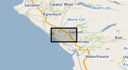
An additional core scanning dataset from the TH0424 drill core that was drilled onshore at Thornton Science Park, Cheshire, UK as part of the UK Geoenergy Observatories (UKGEOS) Cheshire ground investigation funded by UKRI/NERC. The approximately 100 m long core succession comprises the Sherwood Sandstone Group. This additional core scanning dataset pack contains high-resolution optical images and X-ray fluorescence (XRF) downcore point measurements obtained using a Geotek Core Workstation (MSCL-XYZ) at the Core Scanning Facility (CSF) at the British Geological Survey (BGS).
-

A core scanning dataset from the BHA-101 drill core that was drilled onshore at the Ince Marshes site near the village of Elton, Cheshire, UK as part of the UK Geoenergy Observatories (UKGEOS) Cheshire ground investigation funded by UKRI/NERC. This core scanning dataset pack contains high-resolution optical and radiographic images, X-ray fluorescence (XRF) and physical property downcore point measurements on core from 71.12 m to 121.1 m (Sherwood Sandstone Group) obtained at the Core Scanning Facility (CSF) at the British Geological Survey (BGS).